ENVIRSC 1C03 Lecture Notes - Lecture 10: Lake Huron, Lapse Rate, Graupel

1 Mar 2017
School
Department
Course
Professor


Document Summary
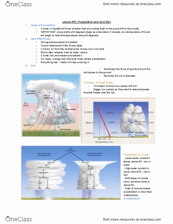
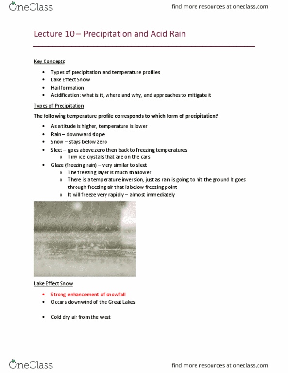
Based on the temperature profiles we can see the different temperatures (look at questions below) Occurs downwind of the great lakes- anywhere by large bodies of water. The dry winds moving over large body of water, the lake releases latent heat and the water vapour it will start condense and these clouds are forced to rise above- trigger snow fall. Base of the cloud is above freezing point and the top of the cloud is below freezing point. Associated with cumulonimbus clouds: difference of temperature between the base and top of the cloud. Warm moist air which will condense along the adiabatic lapse rate. Condensation takes place the precipitation will start. Cold air will be denser then the hail will start falling. Formation of snow pellets will be pulled down by gravity. Ice crystals rimed ice crystals snow pallets. Depending on the amount of water contained in the clouds and the temperature depends on what will fall.