GEOG220 Lecture Notes - Lecture 1: Atmospheric Pressure, Partly Cloudy, Water Vapor

21 Feb 2018
School
Department
Course
Professor
Document Summary
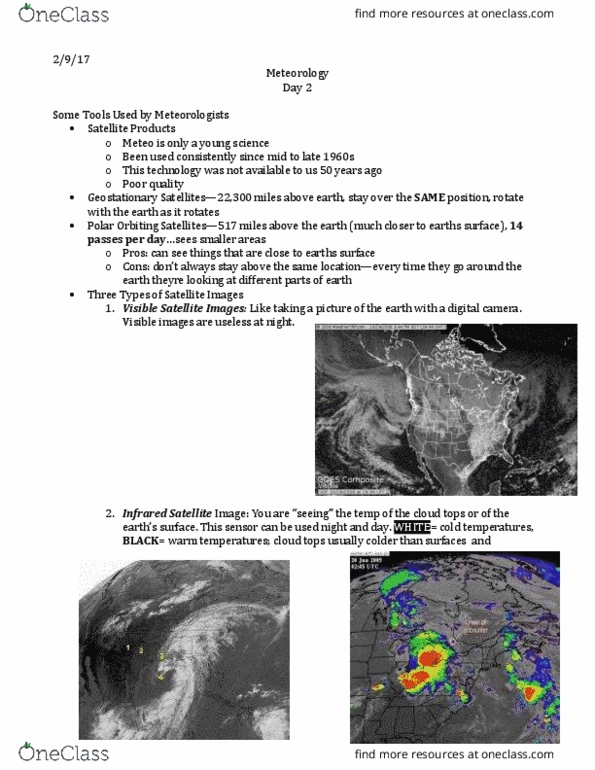
Tools used in meteorological & analysis atmospheric composition and structure. Weather satellites have been used consistently since 1960s. Tech was not available to us just 50 years ago. Geostationary satellites - 22,300 miles above earth - stay over same position - moves with the planets. Polar orbiting satellites - 517 miles above the earth - 14 passes per day, sees smaller area. Visible satellite image: like taking a pic of the earth with your cell phone. The line between light and dark when sunlight goes away in visible satellite images is called the terminator. Infrared satellite image : you are seeing the temp of the cloud tops or the earth"s surface. This sensor can be used during night and day. (white = cold temps, black= warm temps; cloud temps usually have colder than surface) No terminator when looking at infrared since no need for light.