EARTHSC 2WW3 Lecture 3: Lecture 3+4 Notes.docx

26 Oct 2014
School
Department
Course
Professor

Document Summary
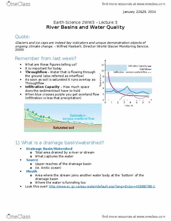
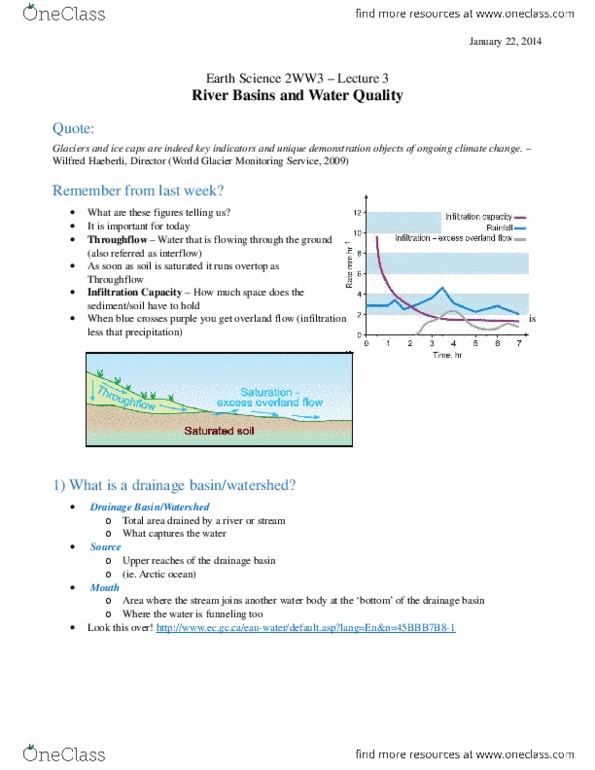
Glaciers and ice caps are indeed key indicators and unique demonstration objects of ongoing climate change. Wilfred haeberli, director (world glacier monitoring service, 2009) Remember from last week: what are these figures telling us, throughflow water that is flowing through the. It is important for today ground (also referred as interflow: as soon as soil is saturated it runs overtop as excess overland flow. Infiltration capacity how much space does the sediment/soil have to hold: when blue crosses purple you get overland flow (infiltration is less that precipitation) Drainage basin/watershed: total area drained by a river or stream, what captures the water. Source: upper reaches of the drainage basin, (ie. arctic ocean) Mouth: area where the stream joins another water body at the bottom" of the drainage basin, where the water is funneling too. Stream discharge: q = v x a, where, We do not have to do this: we assume rectangle in quizzes (unlike below)