GEOG187 Lecture Notes - Lecture 4: Coordinate System, Geographic Coordinate System, Scale Factor

19 Oct 2018
School
Department
Course
Professor
Document Summary
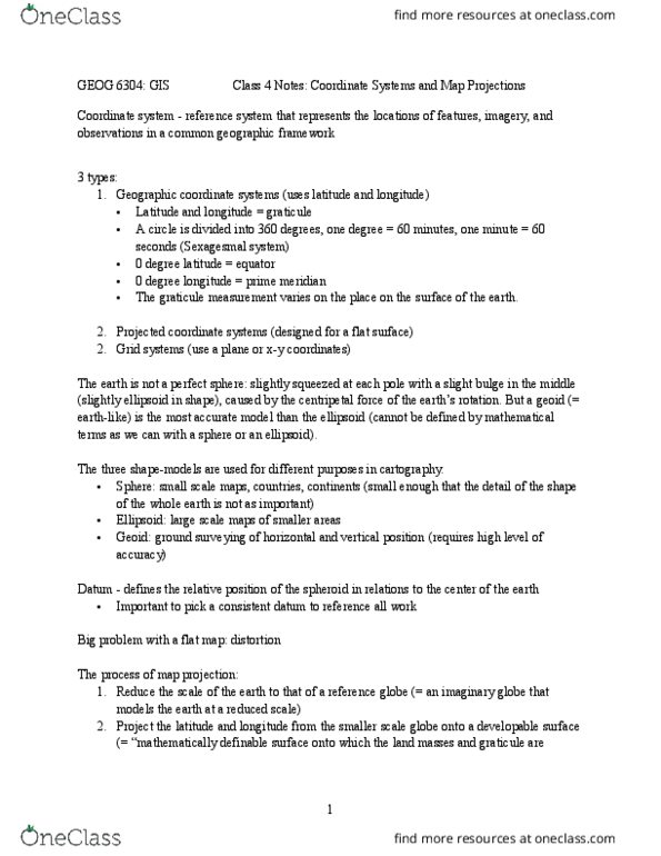
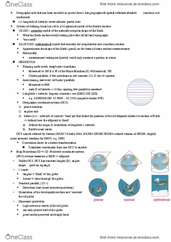
A common unit of measure to describe location: make sure e(cid:448)eryo(cid:374)e is speaki(cid:374)g the sa(cid:373)e (cid:858)la(cid:374)guage(cid:859) Geoid -> ellipsoid -> datum -> coordinate system. A mathematical model that simplifies the geoid. Refere(cid:374)(cid:272)e syste(cid:373) of (cid:858)poi(cid:374)ts o(cid:374) the grou(cid:374)d(cid:859) i(cid:374)terpolate k(cid:374)o(cid:449)(cid:374) poi(cid:374)ts to u(cid:374)k(cid:374)o(cid:449)(cid:374) poi(cid:374)ts. Used to tie ellipsoid to coordinate systems. System of specifying location and points on the surface of the earth. Provides a set of rules that control the simplification of the shape of the earth into a mappable form. Gives a common base frame for the addition of coordinate systems. Survey markers (monuments, control points: the starti(cid:374)g poi(cid:374)t for (cid:373)easuri(cid:374)g the earth(cid:859)s surfa(cid:272)e, points usually marked with brass plates whose identification codes and precise locations (usually in lat/long) are published. Horizontal datum: a set of points (x, y) whose precise location has been determined, which serve as refere(cid:374)(cid:272)e poi(cid:374)ts fro(cid:373) (cid:449)hi(cid:272)h other poi(cid:374)t(cid:859)s lo(cid:272)atio(cid:374)s (cid:272)a(cid:374) (cid:271)e deter(cid:373)i(cid:374)ed.