ESS241H1 Lecture Notes - Lecture 2: Geologic Time Scale, Inclinometer, Cross-Correlation

Document Summary
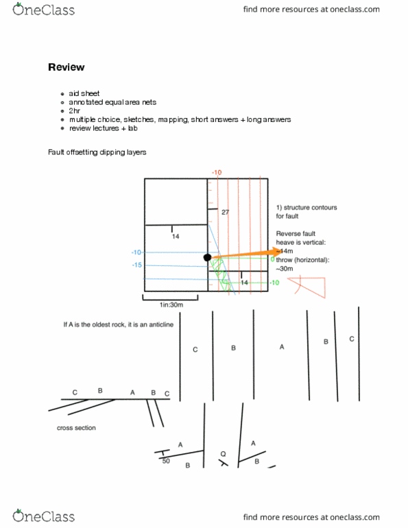
Accuracy of gps example using magnetometer antenna standard deviation 2m but some values o by. >10m errors caused by error in satellite position, poor satellite constellation, atmospheric e ects, multipathing increasing accuracy: di erential gps cross-correlation with carrier phase addition of geostationary satellite. Strike/dip (measured with compass angle to n of intersection between horizontal & planar feature dip angle measured with clinometer use right hand rule ex: 80/45 nnw describe planar features (e. g. contact between sedimentary beds) Bed (smallest unit you"ll see in the eld, but it is too small to be mapped) recognizable bottom & top related to one depositional event. Contact surface separating beds (vertically) can be gradational or abrupt. Formation distinctive (mappable) series of strata name: place name + rock type supai group: hard to distinguish- too similar. Contacts between horizontal layers follow elevation contours and can look quite irregular.