GEOG 106 Lecture Notes - Lecture 5: Cognitive Map, Proprioception, Path Integration

Document Summary
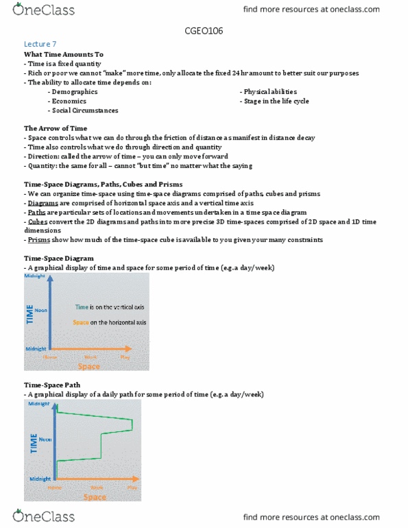
Where people go on a typical day or week. Graph that shows the constraints of travel in space and time. Demonstrates all the potential paths a person could take in a day. Restrictions due to speed and mode of travel, mobility. Space-time paths fits within the space-time prism. Steepness of sides indicates travel speed and maximum travel distance (range) Shallow sides: fast speed or far range. Steep sides: slow speed or narrow range. Hazard events: environmental events that can cause harm to humans. Hazard perception: hazard perception vs. risk assessment. Salient objects or locations that provide navigational cues. A network of place nodes linked by path edges. Map like knowledge metric distances and angles between locations. Review question: knowing the connections between places but without knowing all the exact distances and angles is called: It is visual information about how fast you are moving. It helps your balance and tracks rotations.