EMSE 6340 Lecture Notes - Lecture 2: Nautical Chart, Thematic Map

21 May 2016
School
Department
Course
Professor
Document Summary
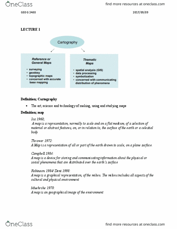
Cartography making and study of maps in all their aspects (science more than art) Gis has a strong database and statistical component . Most basic product of gis is a map (visual representation of a spatial relationship/ any relationship that occurs over space and time) Spatial pertaining to the distribution, distance, direction, area, and other aspects of space on the earth"s surface. The objective of a map is to get a point across in an effective and attractive manner. We should keep these in mind when creating a map: Available data (is the data a point, a line, or a polygon?) Technical limits (content will depend on the production limits such as size and format) Need to consider: map body, inset/overview map, title, legend, scale, orientation/direction indicator, and map metadata. Geographical reference need good base information but also not overcrowd the map. Positioning where the map will be located (right, left, centered)