GEOL 11040 Lecture Notes - Lecture 22: Cascadia Subduction Zone, San Andreas Fault, Seismic Hazard

6 Nov 2018
School
Department
Course
Professor
GEOL 11040 verified notes
22/31View all
Document Summary
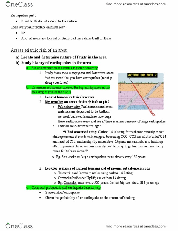
Small earthquakes can indicate where strain is accumulating. Can also indicate where a larger rupture is possible in the future. We only have a century of earthquakes that have been recorded by seismometers. The biggest earthquakes are releasing strain that has built up over centuries to a millennia. Historical records can indicate the intensity and magnitude of earthquakes before records of seismometers. Earthquakes can also leave a geological record, allowing us to learn more about past earthquakes. Seismic hazard maps illustrate the areas with the highest and lowest risk of strong shaking. These help people decide where to build buildings. This area has a _% of shaking (this much or more) Also helps with decision of how strong to make buildings. High risk areas on these maps represent different areas. These maps are only a guess, not an exact prediction! Based on model of active faults and their behavior based on historical record and recorded information.