GEOG 151 Lecture Notes - Lecture 1: Global Positioning System, Geographic Information System, Memphis, Tennessee

16 Sep 2016
School
Course
Professor
Document Summary
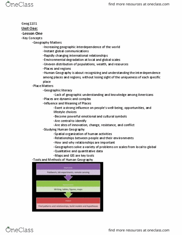
Tools and methods: observation, fieldwork, lab experiments, remote sensing , representation, writing, tables, gures, maps , analysis, find patterns and relationships, build models and hypotheses. 8/30/2016 9/6/2016: a map scale is the ratio between linear distance on a map and linear distance on the earth"s surface. Thematic maps: designed to represent the spatial dimension of particular conditions, processes, or events, isolines (isoleth maps) Map projections: systematic rendering of the earth"s surface onto a at surface, equidistant, conformal, azimuthal, equal-area, distortion of distance, direction, shape, area, cartograms transform space according to statistical factors, distortions emphasize spatial variations. Geographic information system (gis: gis allows us to store, access, and manipulate data, applications, geodemographic daa, market research, land-use change, resource management, military. Five themes in human geography (plerm: place, physical and human characteristics, location, position on the earth"s surface, environment (human-environment interaction, shaping the landscape, region, how they form and change, mobility (or movement, humans interacting on earth.