GISC 4317 Lecture Notes - Lecture 11: Digital Elevation Model, Regular Grid, Interpolation

4 Dec 2016
School
Department
Course
Professor
Document Summary
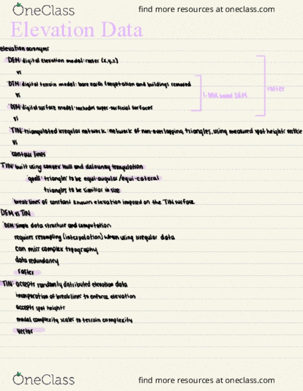
These represent a continuous field of z-values with infinite number of points. Mostly interval or ratio data are in this format. Examples : air temperature, rainfall, population density etc. Surface models can be represented in two ways: Digital elevation model (dem) : raster and regular grid format. Triangular irregular network (tin): vector and irregularly spaced points. Another major representation model is digital terrain model (dtm) which refers to the surface representation of terrains in a digital form. Necessary for deriving acceptable approximation of a surface in gis. The new points can be found out using spatial interpolation with the samples. Dem in gis is a digital file which consists of terrain elevations for the ground positions at regularly spaced intervals. The most common representation of the topography used is us geological survey dem. Elevation, slope and aspect are the attributes of the terrain.