GEOG 4354 Lecture Notes - Lecture 11: Image Registration, Weighted Arithmetic Mean, Change Detection

Document Summary
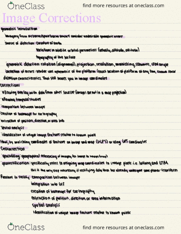
Introduction to remote sensing lab september 30, 2016. Images must be registered to ground locations. Requires knowledge of earth coordinates for locations on image. Obtain source of ground control information (map, gps, survey) Locate common points (control points): store image coordinates (row, column) and ground coordinates (x, y) for each. Your gcps should be well-distributed throughout the entire scene. Develop transformation functions (set of mathematic equations) Evaluate accuracy using root mean square error (rmse) and reduce residuals by dropping poor control points and adding better ones. Spatial interpolation to generate an image at a desired scale, projection or resolution. A master image, or reference image is used to guide the size and orientation of the output image. Nearest neighbor take the value of the input cell closet to the center of the output cell. Bilinear interpolations nearest four points, and estimate the center in a weighted average.