ESSE 3600 Lecture Notes - Graphical Model, Centroid

4 Feb 2013
School
Department
Course
Professor
Document Summary
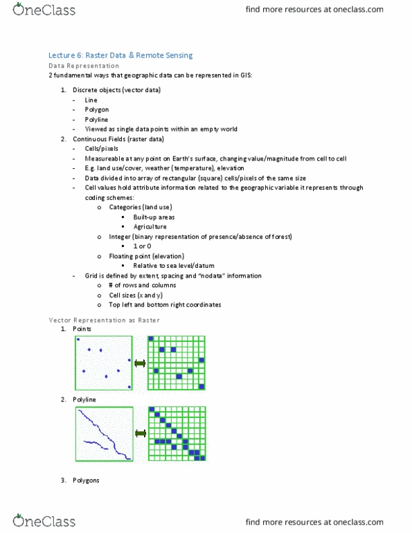
Gis assistants coordinate data from raster into vector. With analysis, consider computational time and the coordinate conversion of data of one coordinate system to another. With raster data, we have a grid and every pixel needs to be transported. Any point can be transferred to different coordinate systems. Pixel information must be inputted into another pixel. If you have a grid, you want to transfer it to the other side. If the original volume is transferred and discretized, we are trying to remove transfer functions. Vector and raster have gotta be aligned with the same axis then transferred. Google maps flies to a specific location, which is the vector model. When we start to google, what we can see from space is the altitude and the topography. Note that with spaghetti vectors, we do not have connections at the end due to the lack of data connections. This is an example of object based relation vectors.