GEOG 205 Lecture Notes - Laurentide Ice Sheet, Forebulge, Sea Level


Document Summary
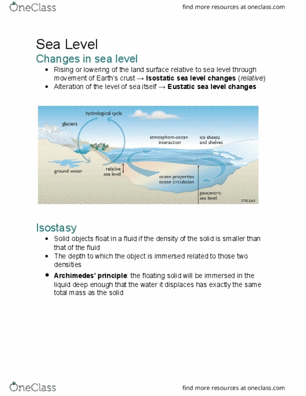
February 11th, 2013: changes in the level of land and sea last glacial maximum 26 000 - 20 000 years ago as thick as 4 km. Laurentide ice sheet covered canada & went south into states ice sheets covered scandinavia & europe & east asia (greater aridity over n asia caused temperatures to not be ideal to create ice sheets) Moisture came from oceans (evaporation & precipitation) Weight of ocean water has effect on earth"s crust under the ocean when sea levels dropped, the continental shelf uplifted this contributed to the decrease in relative sea level. Canada has dykes in the maritimes bay of fundy. Prediction of future sea levels complicated & difficult must predict future temperatures & how much today"s glaciers will melt. As ocean temperatures increase, densities will decrease so volume will increase varies with salinity of sea water regression still happening in some regions.