CVL 736 Study Guide - Final Guide: Web Mapping, Data General, Thin Client

13 Dec 2018
School
Department
Course
Professor
Document Summary
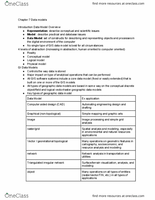
Uses coordinates of scale and parcel- based system spatial objects to analyze data. Uses spatial info to compose graphical feature drawings into layers. Used to design objects to be developed. What types of questions could gis help transportation managers (or other) address: transportation infrastructure life cycle, planning, design, environmental management, construction management, operations/maintenance. What are maps important in gis: characteristics: title, legend, scale bar, north arrow, annotation, data frame, role: present spatial information to the users to support their decision making or problem solving. Representation of a sphere where lines of latitude and longitude are straight and @ right angles. Preserves angles and directions of small areas. Bad for real size and shape of continents and countries. Representation of a sphere where meridians converge @ the poles. Equivalent, but direction and shape are distorted toward the edges. Representation of earth where poles are displayed as long lines instead of points. Shows entire world at once but compromises area and angles.