ESS102H1 Midterm: GLG345-ESS241 Midterm aid sheet

Document Summary
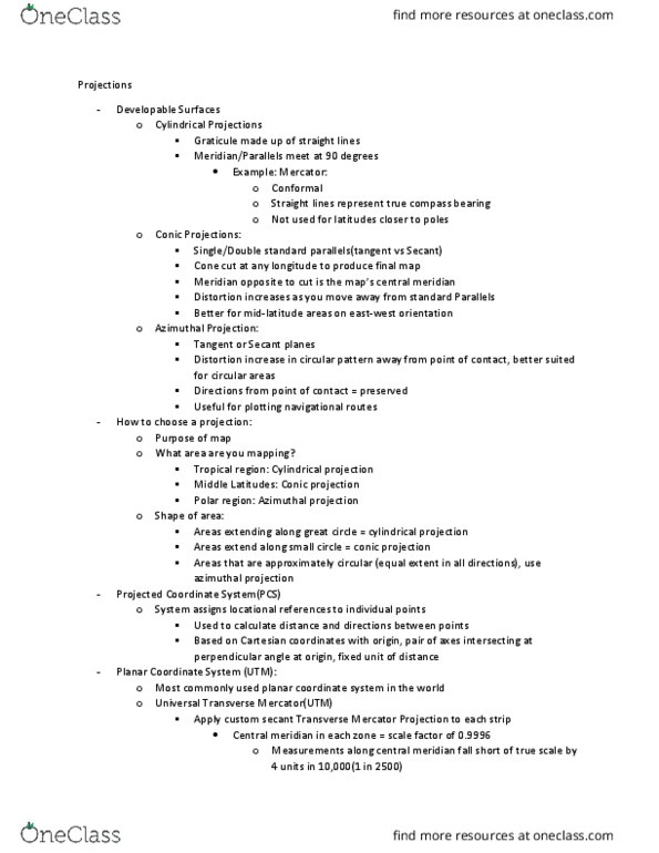
To understand the shape, size and orientation of geological bodies in the earth, and their structures, with particular emphasis on changes in these brought about by deformation. Point on earth needs to be projected onto a plane, three main types: cylindrical, conical, planar. Every map distorts, some maps try to maintain: equal area, equal angle, equal distance (to one focal point), equal shape (conformal) Stereographic preserves shape, orthographic looks realistic, azimuthal shows distance to centre point. Utm (universal transverse mercator) 60 horizontal cylinders touch the globe along a meridian covering 6 degrees each, northing = distance from equator or south pole, easting = distance from central meridian plus 500km. Gps - cartesian system, 24 satellites, each with precise atomic clock receiver compares time signal was sent to time signal was received, then calculates distance and can triangulate location (and time) using at least 4 satellite signals.