GEOG372 Study Guide - Final Guide: Remote Sensing Systems, Geographic Information System, Linear Referencing

5 Dec 2016
School
Department
Course
Professor
Document Summary
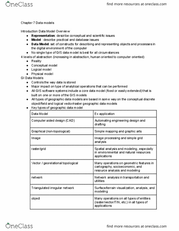
Desktop systems- what most people think of as gis. Web mapping - provided via easily accessible, open interfaces running in web browsers and returning image tiles. Server gi systems - runs on a computer server that can handle concurrent processing requests from range of networked clients. Heart of any gis is the data model. Model - describe practical and database issues. Data model - set of contructs or describing and representing objects and processes in the digital environment of the computer. Use local drawing coordinates *survey control points* Focused on graphical representation of objects, and cannot store relationships. Individual objects do not have unique identifiers *depends* Computer cartography (graphical) data models similar to cad,m used to digitize paper maps. Array of cells, represent real world objects. Cells can hold attribute values based on one of several encoding schemes including categories, and integer and floating-point numbers.