GEOG 1113 Chapter Notes - Chapter 1: Thermodynamics, Universal Transverse Mercator Coordinate System, Geographic Information System

Document Summary
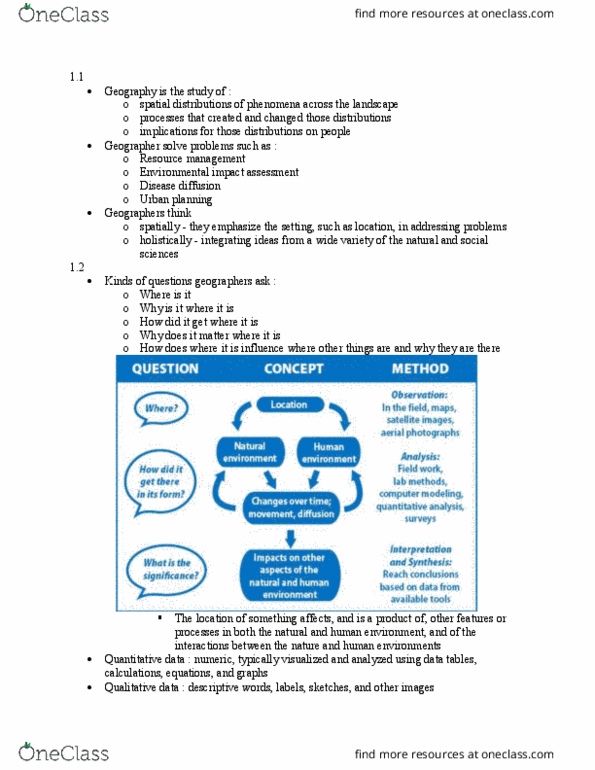
How does where it is influence where other things are and why they are there: their concepts flow from: Location -> natural environment/human environment -> changes over time (movement, diffusion) -> impacts on other aspects of natural and human environment: the method has 3 steps: Analysis (field work, lab methods, computer modeling, quantitative analysis, surveys). Qualitative data includes descriptive words, images, labels, etc: quantitative data involves numbers and measurements, how do we test alternative explanations, steps in the investigation: Proposed explanations and predictions from each explanation. Involves erosion, burial, melting, and uplifting of mountains. It goes 10 kilometers above and below the surface/sea level: life interacts with all the spheres and the cycles. Elevation, depth, and relief: height above sea level is elevation, beneath the water is depth, and differences in elevation from one form to another is called topographic relief.