EARTHSC 1G03 Lecture Notes - Lecture 10: Universal Transverse Mercator Coordinate System, Declination, Romer

5 Apr 2017
School
Department
Course
Professor
Document Summary
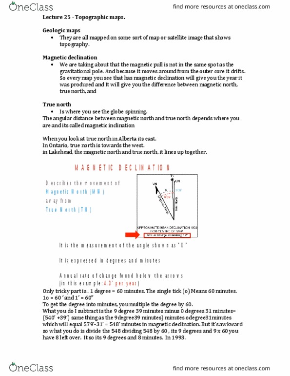
Describes the movement of magnetic north (mn) away from true north (tn) It is the measurement of the angle shown as x . Annual rate of change found below the arrows (in this example: 4. 3" per year) Contour lines are lines that show the elevation of a place or thing. When far apart, contour lines show a gentler slope. W h e n c l o s e t o g e t her, contour lines show a steeper slope. Use your coordinates to locate your start and end points. Use the first contour line you come to as the elevation for each point, calculate the differences in elevation. Calculate the real world distance between them using a ruler and the map scale. Both systems use the intersection of an x and y plane. Units of measurement are angular and are shown in degrees, minutes and seconds. A degree is designated by a superscript .