GEOG281 Lecture Notes - Lecture 9: Digital Elevation Model, Root Mean Square, Confusion Matrix

2 Apr 2016
School
Department
Course
Professor
Document Summary
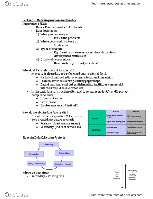
Study area: types of analysis e. g. forestry vs. emergency services dispatch vs. development control, etc, quality of your analysis. Access to high quality, geo-referenced data is oten diicult. Historical data collecion oten no locaional dimension. Digital data may exist but conideniality, liability, or commercial interests may disallow broad use. In the past, data construcion oten said to consume up to of gis project budget and ime! How do we obtain data for our gis: one of most expensive gis aciviies. Administraive records data as by-product: within your organizaion, other organizaions. Raster remote sensing e. g. spot and ikonos satellites and aerial photography. Locaion of objects determined by angle and distance measurements from known locaions. Uses expensive ield equipment and crews: most accurate method for large scale, small areas. Collecion of satellites used to ix locaions on earth s surface. Data collected for other purposes can be converted for use in gis. Important scanning parameters are spaial and spectral (bit depth) resoluion.