PLAN105 Lecture Notes - Lecture 17: N100, Arcview, Quantile

2 Jan 2017
School
Department
Course
Professor
Document Summary
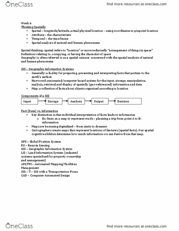
Lecture: week 9 technological approaches and the urban environment. Spatial thinking (cid:862) patial(cid:863) (cid:396)efe(cid:396)s to (cid:862)lo(cid:272)atio(cid:374)(cid:863) o(cid:396) (cid:373)o(cid:396)e te(cid:272)h(cid:374)i(cid:272)all(cid:455) a(cid:396)(cid:396)a(cid:374)ge(cid:373)e(cid:374)t of thi(cid:374)gs i(cid:374) spa(cid:272)e. Definition: relating to, occupying, or having the character of space. Geography is often referred to as a spatial science concerned with the spatial analysis of natural and human phenomena (geography as a study of the spatial distribution of phenomena. Planning is spatial creating places resolving land use form and function in city. The (cid:374)atu(cid:396)e of data thi(cid:374)k of a phe(cid:374)o(cid:373)e(cid:374)a of i(cid:374)te(cid:396)est . Ways to represent location: x, y, z location relative to the frame defined, utm (universal transverse mercator) coordinates or latitude and longitude. Use of projection (3d to 2d) and transformation key to mapping location relative to earth surface location: others. Broad definition a facility for preparing, presenting, and interpreting facts that pertain to the ea(cid:396)th(cid:859)s su(cid:396)fa(cid:272)e: e. g. maps, computer systems. Map a collection of facts about objects organized according to location.