CONS 127 Lecture Notes - Lecture 1: Eurocentrism, Conformal Map, Prime Meridian (Greenwich)

15 Sep 2017
School
Department
Course
Professor

Document Summary
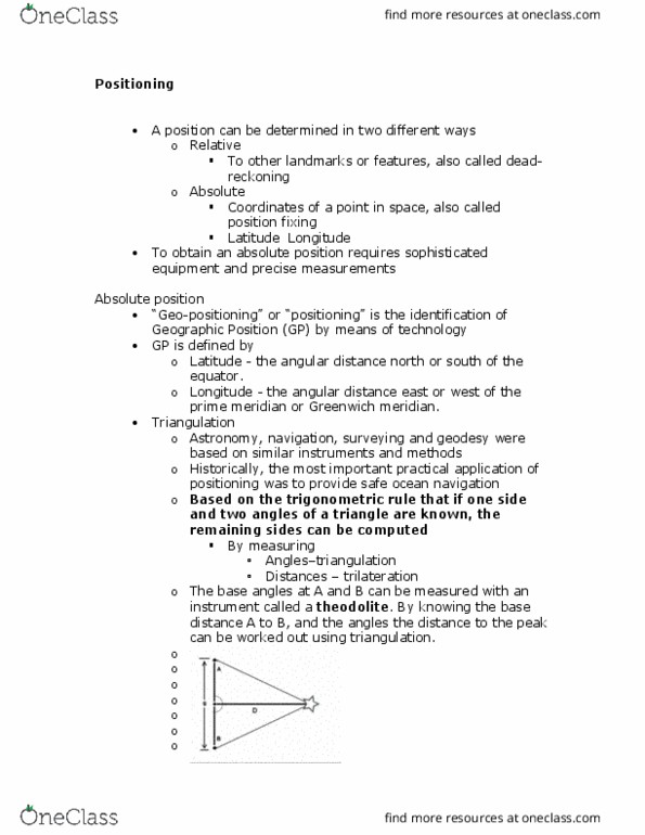
Observing your position on earth: first map to ever use a grid system was in 1400s, first attempt of latitude and longitude on map. The equator is the biggest parallel: arctic circle: northernmost latitude in the northern. Hemisphere where the sun can remain continuously above or below the horizon for 24 h: antarctic circle: southernmost latitude in the southern. Hemisphere where the sun can remain continuously above or below the horizon for 24 h: tropic of cancer: northernmost circle of latitude where the. Shape of the earth: not quite a perfect sphere, geodesy is the science other studies and determines the shape and dimensions of the earth, sphere (simplest) Simplest (and least accurate) approximation of the shape of the earth. The earth"s radius is constant: a=b, the earth is actually slightly warped, the north and south points push into the earth bulging more on the sides, ellipsoid (more complex, mathematical approximation of the shape of the.