GEOB 103 Lecture Notes - Lecture 2: Synthetic Aperture Radar, Digital Elevation Model, Tectonic Uplift

23 Nov 2017
School
Department
Course
Professor
Document Summary
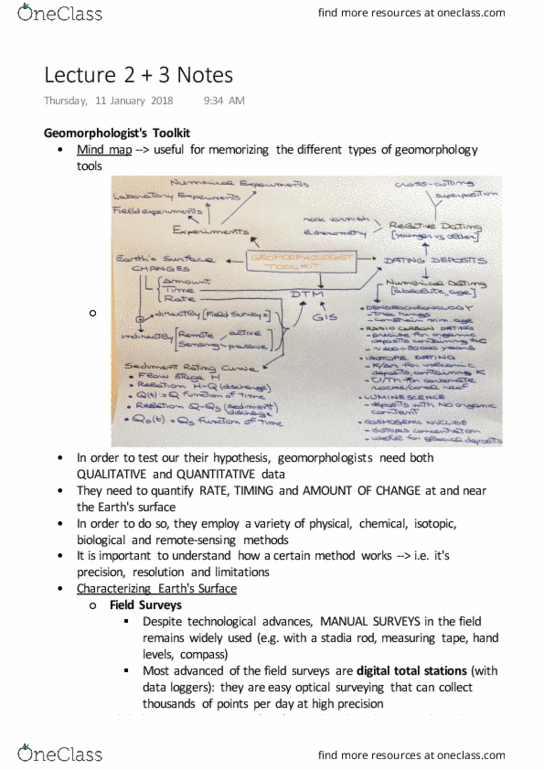
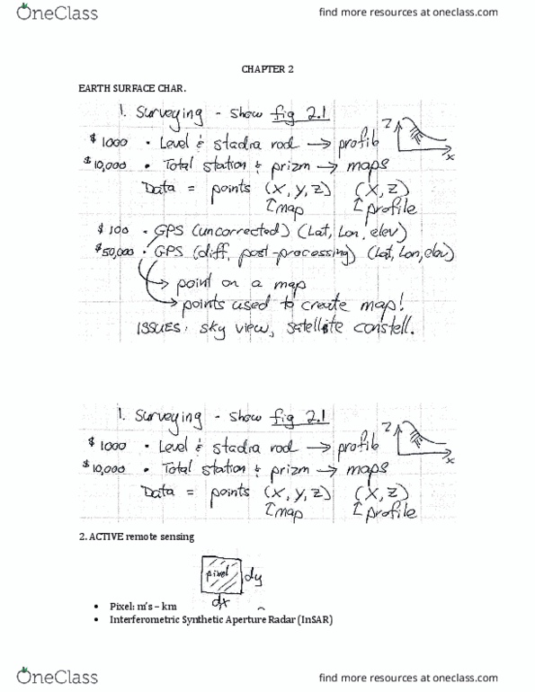
Uses distance to measure change in level of distance & elevation (simple) Gives x (distance), y (direction), z (change in elevation) Bounces off satellites to fine x, y, z. Error in position in x, y, z space depends on # of available satellites & blockage (trees) No error b/c it uses base station (stationary station tracks changes in atmosphere that affects signal. Point used to create accurate maps, increased precision, changes in tectonic uplift rates. Radar passes over point o(cid:374) earth"s surface, examines change between passes, can see motion very sensitive. Satellites (can see glacial changes), maps earth"s surfa(cid:272)e. 1990 global coverage (latitude <55 , does(cid:374)"t (cid:449)ork i(cid:374) polar regio(cid:374)s) uses sar (synthetic aperture radar) to collect topographic data. Laser light pulse sent out & timed for return. Can look at positions on smaller landforms very precise. Map, 1-10m resolution shows changes in surface (without trees/interference: 3.