GEOB 270 Lecture Notes - Lecture 7: Universal Transverse Mercator Coordinate System, Cartesian Coordinate System, Great Circle

25 Dec 2016
School
Department
Course
Professor
Document Summary
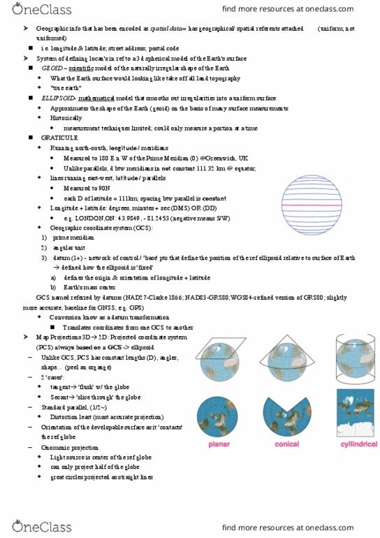
Example: mercator: conformal, straight lines represent true compass bearing, not used for latitudes closer to poles, conic projections: Cone cut at any longitude to produce final map. Meridia(cid:374) opposite to cut is the (cid:373)ap(cid:859)s ce(cid:374)tral (cid:373)eridia(cid:374) Distortion increases as you move away from standard parallels. Better for mid-latitude areas on east-west orientation: azimuthal projection: Distortion increase in circular pattern away from point of contact, better suited for circular areas. Directions from point of contact = preserved. Polar region: azimuthal projection: shape of area: Areas extending along great circle = cylindrical projection. Areas extend along small circle = conic projection. Areas that are approximately circular (equal extent in all directions), use. Projected coordinate system(pcs) azimuthal projection: system assigns locational references to individual points. Used to calculate distance and directions between points. Based on cartesian coordinates with origin, pair of axes intersecting at perpendicular angle at origin, fixed unit of distance.