ANTH 003 Lecture Notes - Lecture 17: Ground-Penetrating Radar, Simple Random Sample, Landscape Archaeology

29 Oct 2020
School
Department
Course
Professor
Document Summary
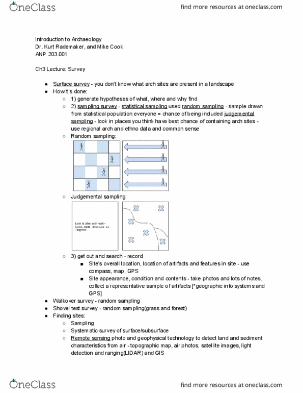
In sum: survey refers to suite of methods for extensively documenting surfaces. Systematic test pitting and develops a mapping of the concentration of artifacts. But also, to say where stuff is not. Addresses complex ways human shape the land around them (both consciously. Symbolic processes embedded in their sense of place. Integration or archaeology, oral history, documentary evidence to study and. Landscape archaeology: inspires question: why or why not here? interpret landscapes (past and present and unconsciously) Probabilistic vs. non-probabilistic (weaker than probabilistic) samples. Non-probabilistic sampling: visible on surface (n=visible sites) Split into grid and random number generator. Every unit has equal probability of being chosen (all the. Designate different sample areas depending on what we. Example of systematic: space units more broadly already know. Acquire and maintain accurate locational data or cultural. Provide shared (or restricted) access to data. Develop customized gis maps, tools and applications. Gis layers to customize maps for online and print use.