SFR 106 Lecture Notes - Lecture 7: Incident Command System, Arcgis, Emergency Management

22 Dec 2016
School
Department
Course
Professor
Document Summary
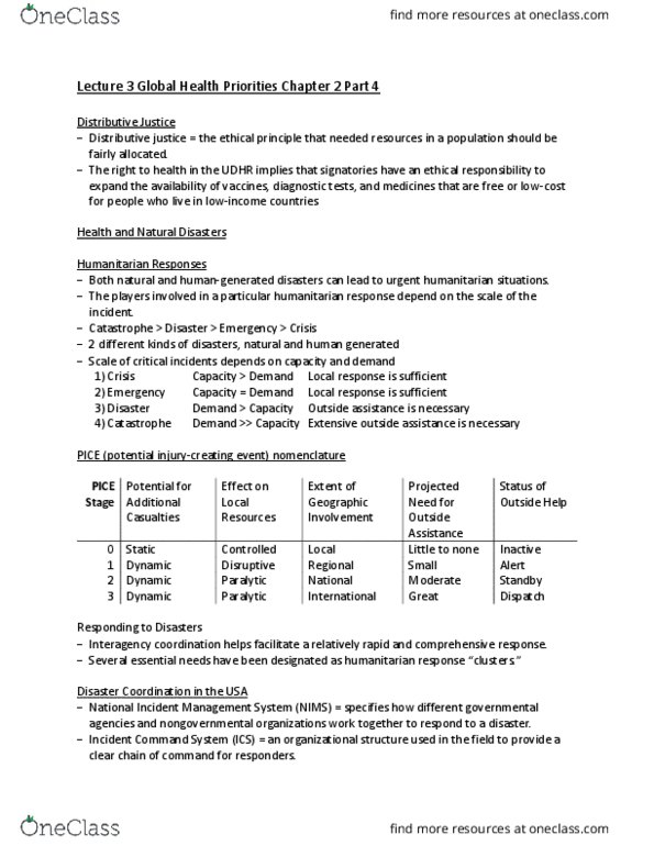
Fire and gis (intro of tools used in gis and emergency management) Incident mapping outline: incident command systems (ics, geographic information systems technician (gist, gis tools, gis data management, standard mapping products. A structure to help organize resources during a emergency management situation or incident. Based on emergency response to life or resource threatening situations. Ics provides and adapts it"s organizational structure to any emergency or incident to which emergency response agencies would be expected to respond. Ics expands in a logical manner from an initial response situation into a major incident. Gist work from the incident command center during major incidents. Gist"s are usual point contact to situation unit leaders and incident commanders. Provides cartographic mapping illustrations of the major incident for information. Also includes operating personnel and the data that go into the system: hardware, software, data, people, methods. Real world features are represented as individual themes according to feature type.