GEOG 5 Lecture Notes - Lecture 4: Choropleth Map, Contour Line, Cartogram

Document Summary
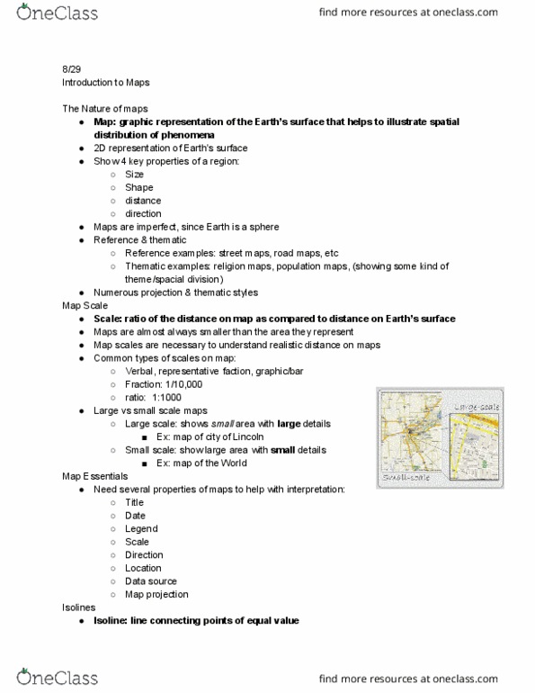
Geog 5 notes: random pattern= more dispersed; actual pattern= more clustered, maps are models of the earth. Pictorial model of reality: earth"s surface & distributions of features. Visualization: tell a story, show results, communicate findings & issues. Ex: phone, gps,etc: map scales describe relationship/ratio between distance on a map w/corresponding distance on the ground. 1:63360 1 inch on map= 63360 inches on real world. 1 inch: 5280 feet 1 inch on map= 5280 feet on real world. 1 inch: 1 mile 1 inch on map= 1 mile on real world: small-scale map shows large areas & large-scale map shows small areas. Reference: general purpose, simply to show w/o interpretation; any type of feature (man made or natural); answers what is there? . Ex: political just showing countries of the world. Thematic: presents graphic theme- spatial distribution; answers what"s the pattern of this variable? (ex: distribution of wealth throughout a country, amount of rainfall, etc. )