GEOG 1101 Lecture Notes - Lecture 14: Polar Front, Cumulonimbus Cloud, Nimbostratus Cloud

7 Feb 2017
School
Department
Course
Professor
Document Summary
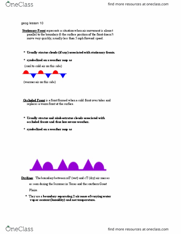
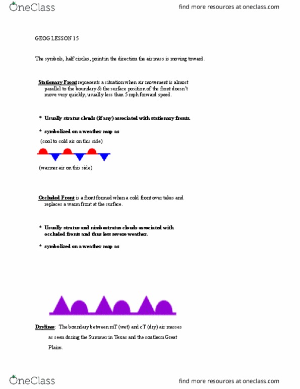
A front is an invisible boundary separating air masses of different characteristics, primarily humidity, density and temperature. One air mass is usually warmer (or colder) then the other and of differing humidity level. Polar front refers to the zone separating air masses of polar origin from air masses of tropical origin. Wave cyclones refers to a weather pattern which may develop in conjunction with or along the polar front. * low pressure cells and fronts are primary structure of a mid-latitude wave cyclone. Types of fronts: cold, warm, stationary, & occluded. Cold front is the boundary at the forward edge of an advancing cold air mass that is displacing warmer air (move faster than warm front) * they move at an average speed of approximately 25-35 mph forward speed, and have a steep slope of 1:100. * cumulus and cumulonimbus clouds are typically associated with cold fronts.