GGR376H5 Study Guide - Final Guide: Autocorrelation, Arcgis, Centroid

Document Summary
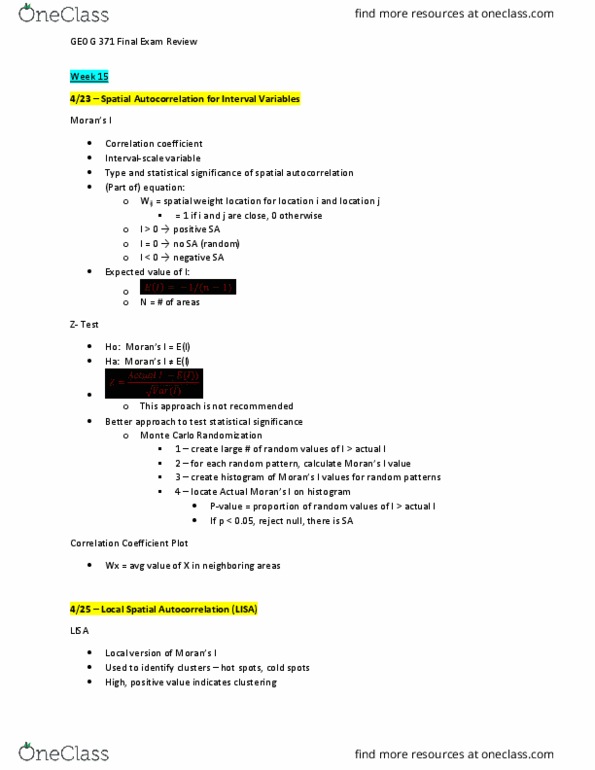
Single value calculated across all spatial units: points, polygons. Measure of the overall clustering of the data. Arcgis, spatial statistics toolbox -> analyzing patterns toolset or use. Identifies spatial concentrations: when g is relatively high it indicates high value clusters, when relatively low indicates low value clusters. Contiguity: binary, zones that share boundaries = 1. Distance is continuous: measured historically, distance between polygon centroids. Local moran"s i: lisa (local indicator of spatial association) A method of constructing new data points within the range of a discrete set of known data points. One dimensional, linear approach, within range of data. Prediction of values at unknown values: rainfall, air pollution, ground water depth, elevation. Exact, value at a known location value will remain. Approximate values at a known location may change. Individual areas of influence around each point of a set. Boundaries define the area that is nearest to each point relative to all other points.