ANTH 2015 Chapter : MAPPING IN ARCHAEOLOGY

Document Summary
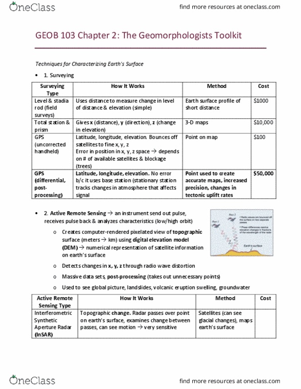
Purpose of a transit in archaeology: to make a topographic map of a site; to set out places to excavate. Elevation: height difference between transit and stadia. Angle: degrees east or west of direction in which transit is set up. Read the number on the stadia rod where the central stadia hair crosses. Compare the number with the instrument (transit) height. Look through the telescope of the transit. Count the numbers between the central and upper stadia hairs. Use a survey notebook to record data. Contours = lines on the map showing elevation. Contour lines = places of equal elevation contour lines cannot intersect! Look at your site and select contour interval appropriate to show elevation differences. Start from the datum point where the transit was set up (1. 0 m elevation) Join the points to make contour lines. Trace topographic map on a computer tablet and store map in computer.