CLCV 1008 Lecture Notes - Lecture 11: Lost City, Post-Excavation Analysis, Exploratory Data Analysis

10 Mar 2016
School
Department
Course
Professor
Document Summary
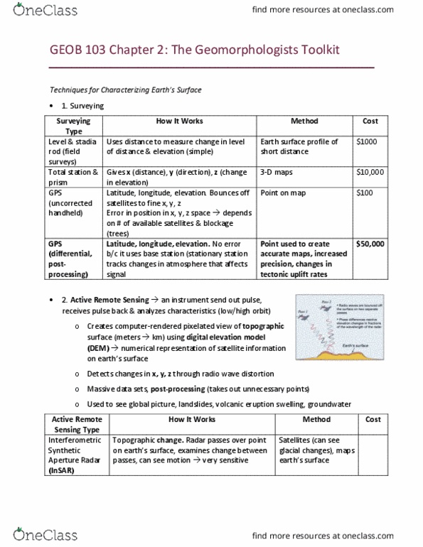
Nasca lines: what happened to the people. Developments in clued use of gps, google earth, digital imaging, digital enhancement of images being used, lidar. Broad term, for inding and mapping sites from high apitude. Deiniion: group of techniques that permit detecion of phenomena that are unnoiced by the human eye. Done by an undamaging method from above the earth. Example: spaced based laser mapping, photos from airplane. Lidar: light detecion and ranging, also als, airplane is equipped with laser scanner, posiion of plane known by gps. Scanners send billions of laser pulses to the ground. Carefully calibrated sensors measure the pulses when they return to the plane. By measuring this, a 3d digital map can be produced of the ground. (photons (pulses) bounce of tree, some penetrate through leaves, some hit ground) Important to do at end of the dry season when forests are most depleted: pg 84.