GEOG 2480 Lecture Notes - Lecture 15: Euphrates, American International Group, Image Rectification

8 Dec 2017
School
Department
Course
Professor

Document Summary
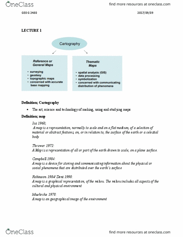
Digital orthorectified imagery: 4 framework thematic databases . Transportation: several other databases such as . Demographic information: the gsdi association is an inclusive organization of agencies, firms, and individuals from around the world. A set of tools for collecting, storing, retrieving at will, transforming, and displaying spatial data from the real world for a particular set of purposes. An information system used to manipulate, summarize, query, edit, and visualize spatial and non-spatial information stored in a computer database. A digital system for the acquisition, management, analysis, and visualization of spatial data for the purposes of planning, administering, and monitoring the natural and socioeconomic environment. An automated system for the capture, storage, retrieval, analysis, and display of spatial data. Historical cartography: word cartography (map-making) comes from the greek chartis (map) and graphein (to write or draw, the science and practice of making representation of the earth on a two-dimensional flat surface or three-dimensional globe.