ANT306H5 Lecture Notes - Lecture 7: Universal Transverse Mercator Coordinate System

Document Summary
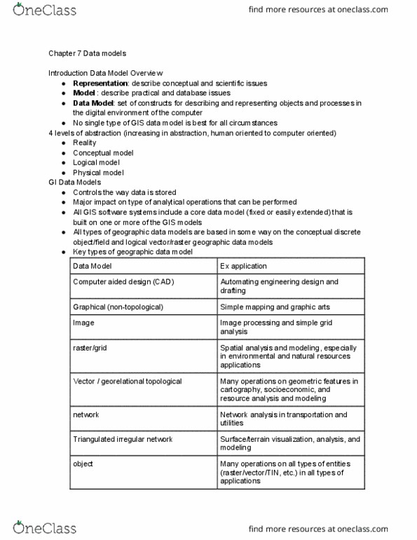
Geographical information systems: a method of visualize, manipulate analyze, and display spatial data, provides a link between a database with geo-themed information and a map visualizer. Includes attribute information (description/names of artifacts) what is it. Analysis (exploring relationships between the datasets, attributes, etc. Raster grids: images, grids, a location and value, satellite images and aerial photos are already in this format. Vector - linear: lines, points, polygons, features house, lake, etc, attributes, size, type length, etc. Projections can minimize distortion in elements such as scale, area, distance, direction and shape. Choice of projection depends on many factors particularly the purpose of the map. Why a utm projection: universal transverse mercator divided into 60 separate zones, 6 degrees wide. Why a utm projection: each zone is given a central meridian, 6 degrees in width, transverse mercator maps are often used to portray areas with larger north-south than east-west extent.