Biology 2483A Lecture Notes - Lecture 23: Biogeochemical Cycle, Roadkill, Species Richness

29 Jan 2015
School
Department
Course
Professor
Document Summary
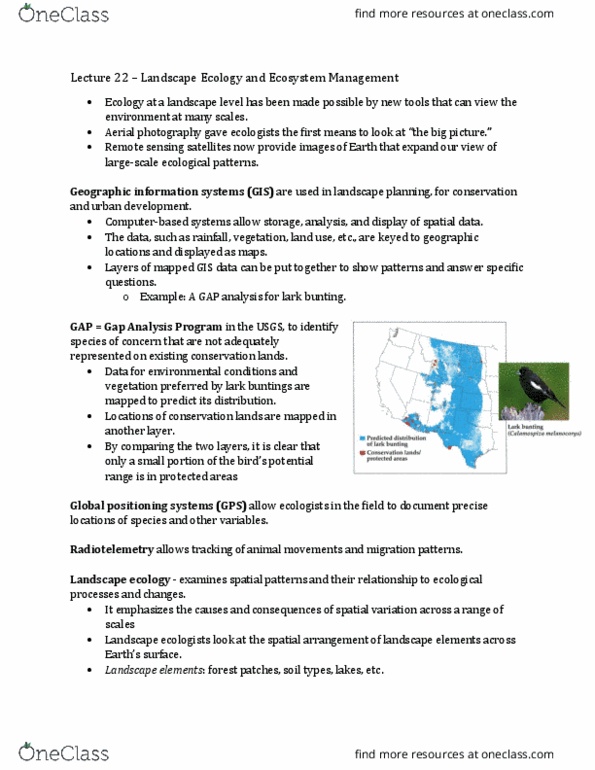
Geographic information systems (gis) are used in landscape planning, for conservation and urban development. Computer-based systems allow storage, analysis, and display of spatial data. The data, such as rainfall, vegetation, land use, etc. , are keyed to geographic locations and displayed as maps. Global positioning systems (gps) allow ecologists in the field to document precise locations of species and other variables. Radiotelemetry allows tracking of animal movements and migration patterns. Data analysis and gis continually improve with better computers and statistical methods. Landscape ecology examines spatial patterns and their relationship to ecological processes and changes. Landscape ecology emphasizes the causes and consequences of spatial variation across a range of scales. Landscape ecologists look at the spatial arrangement of landscape elements (e. g. forest patches, soil types, lakes, etc. ) across earth"s surface. A landscape is an area in which at least one element is spatially heterogeneous; it often includes multiple ecosystems. Heterogeneity includes different types of landscape elements, and how they are arranged.