GEOL 1 Lecture Notes - Lecture 26: Drainage Basin, Cut Bank, Point Bar

3 Dec 2020
School
Department
Course
Professor
Document Summary
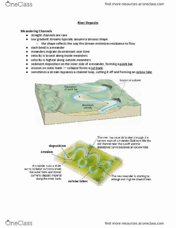
Drainage basin total land area feeding water into a river. Channels path the water is flowing along. Tributaries - smaller streams and creeks that merge together forming larger streams. Always flows downhill and follows path of least resistance. Branching/dendritic basic everyday pattern, looks like tree branch, sharp angles. Radial highest point of elevation in center. Rectangular meet at 90 degree angles, looks blocky, forms with highly fractured bed rock. Levee low mound of sediment right next to channel, sediment added with each flood. Floodplain flat area around river where water will end up with flood. Braided streams many smaller streams braided together to make larger river. Large sediment supply get clogged and split to make more channels. Easily erodible banks spreads out wider as bank erodes. Straight channel, point a to point b. Water flowing much slower, moves around obstacles. Cut bank water moving faster, getting cut away over time. Point bar water moving slower, less erosion, may deposit sediment.