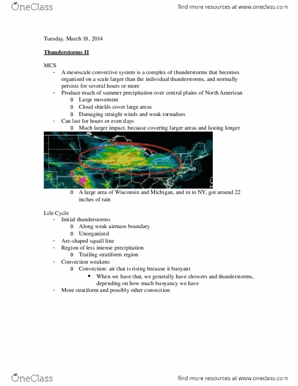
ATOC 184 Lecture Notes - Lecture 11: Norwegian Cyclone Model, Occluded Front, Cold Front

12 Apr 2014
School
Department
Course
Professor
Document Summary
Cold air mass displacing a warm air mass. Counterclockwise motion, drawing in cold, dry air in the northwest flow behind he storm, and drawing in warm, moist air in the southerly flow ahead of the storm. It"s advancing to the east and bringing with it cold, dry air. Warm air pushing northward in to the cold air. Gray area represents the area of cloud and precipitation that area is much larger ahead of the warm front, then ahead of the cold front: this is because our cold air is more dense. The closer the clouds are to the ground, the closer you are to the warm front. If you want to know if air is stable or unstable, just have to look at the type of clouds that are forming. If the clouds are pancake (mmm) like, the atmosphere is stable smooth clouds. If the clouds are puffy and cottony, the atmosphere is likely unstable.