Geography 2011A/B- Final Exam Guide - Comprehensive Notes for the exam ( 33 pages long!)

29 Mar 2018
School
Department
Course
Professor
Document Summary
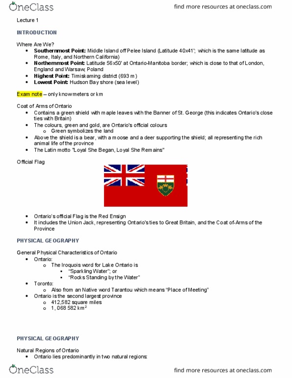
Geography of ontario and the great lakes: southernmost point: middle island off pelee island (latitude 40x41"; same as rome, italy, and. Northern california: northernmost point: latitude 56x50" at ontario-manitoba border; which is close to that of. London, england and warsaw, poland: highest point: timiskaming district (693 m/2,274 ft. ) Coat of arms of ontario: green shield with maple leaves with the banner of st. george (indicates. O(cid:374)tario"s ties to great britai(cid:374), a(cid:374)d the coat of ar(cid:373)s of the pro(cid:448)i(cid:374)(cid:272)e. General physical characteristics of ontario: called upper canada before ontario, york was the capital of ontario but was changed to toronto, ontario: Iroquois word for lake ontario (cid:862) parkli(cid:374)g water(cid:863) (cid:862)ro(cid:272)ks ta(cid:374)di(cid:374)g (cid:271)y the water(cid:863: toronto: Tarantou = (cid:862)pla(cid:272)e of meeti(cid:374)g(cid:863: 2nd largest province. Natural regions of ontario: ontario lies (predominantly) in 2 natural regions: Interior plains and lowlands: hudson bay plains (interior plains, lowlands (great lakes-st. lawrence, red/purple means higher levels of elevation, the red area is the canadian shield.