GEOG 1HB3 Lecture Notes - Lecture 4: Mercator Projection, Electric Light, Human Geography

12 Oct 2016
School
Department
Course
Professor
Document Summary
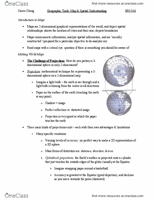
Geography lecture note 4: maps and spatial understanding. Maps are 2-dimensional graphical representations of the world, and depict spatial relationships. Projection: mathematical technique for representing a 3-dimensional sphere on a 2-dimensional map. Three main kinds of projections exist- each with their own advantages & limitations. Main forms of distortion are distance, direction, & area: cylindrical projections: the earth"s surface is projected into a cylinder that just touches the outside edges of the globe (usually at the equator) Accuracy is greatest at the equator, and declines as you move towards the poles. Example: the mercator projection: conical projections: the earth"s surface is projected onto a cone that touches the outside edges of the globe (in the mid-latitudes), i. e 30 degree"s- 60 degree"s n/ ) Accuracy is greatest in the mid-latitudes: azi(cid:373)uthal projectio(cid:374)s: the earth"s surface is projected i(cid:374)to a flat surface that touches the globe at one point only (usually the polar regions)