GEOG 1HB3 Chapter Notes - Chapter 1: Contour Line, Spatial Analysis

15 Apr 2016
School
Department
Course
Professor
Document Summary
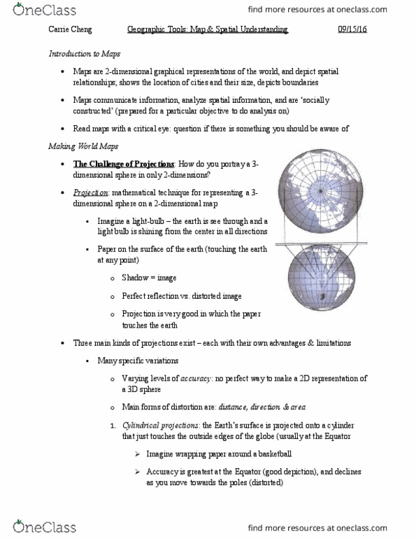
Geog 1hb3 chapter 1: maps and spaial understanding. Maps are two dimensional graphical representaions of the world, and depict spaial relaionships. Mathemaical technique for represening a 3-dimensional sphere on a 2-dimensional map. Giant piece of paper on the surface of the earth and projects a shadow. Three main kings of projecions exist each with their own advantages and limitaions. Main forms of distorion are: distance, direcion, and area. Cylindrical projecion the earth"s surface is projected onto a cylinder that just touches the outside edges of the globe (usually at the equator) Accuracy is the greatest at the equator and declines as you move toward the poles. The earth"s surface is projected onto a cone that just touches the outside edges of the globe (usually in the mid laitudes, 30-60 degrees n/s) The earth"s surface is projected onto a lat surface that touches the globe at one point only (usually polar regions)