GEOG 1HB3 Lecture Notes - Lecture 4: Cartogram, Contour Line, Lambert Conformal Conic Projection

25 Jan 2018
School
Department
Course
Professor
Document Summary
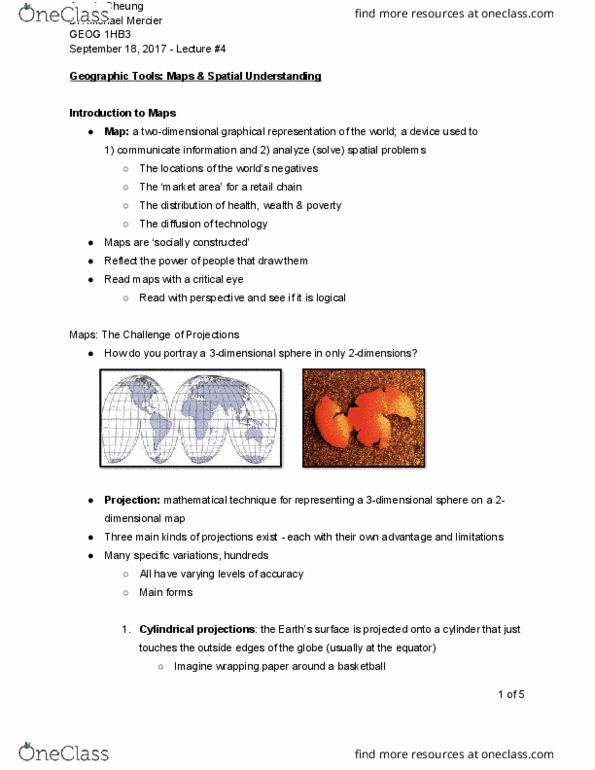
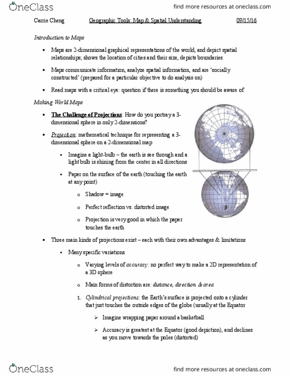
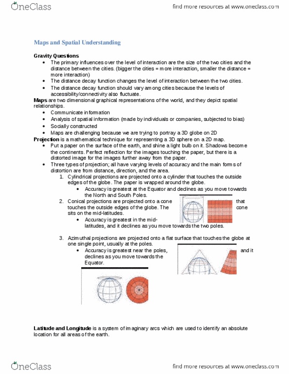
Map: a two dimensional graphical representation of the world; a device used to: Reflect the power of the people to draw them. It is important to read maps with a critical eye. Projection: mathematical technique for representing a 3d sphere on a 2d dimensional map. Many specific variations - each with their own advantages and limitations. Main forms of distortion are: distance, direction and area (1) Cylindrical projections: the earths surface is projected onto a cylinder that just touched the outside edges of the globe (usually at the equator) Accuracy is greatest at the equator and declines as you move toward the poles. Conical projections: the earth surface is projected onto a cone that touches the outside edges of the globe ( in mid latitudes) Azimuthal projections: the earth"s surface is projected onto a flat surface that touches the globe at one point only (usually the polar regions)