GEOG 2OC3 Lecture 7: The West

26 May 2018
School
Department
Course
Professor

The West
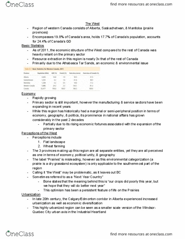
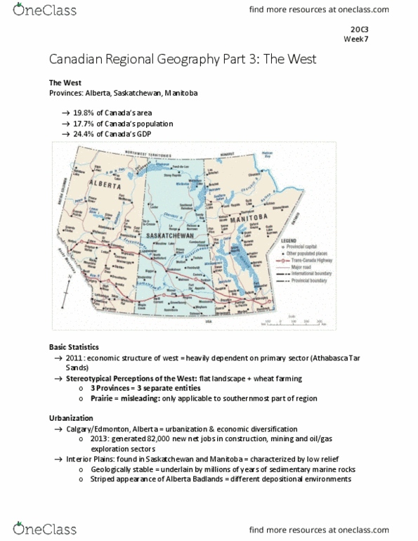
The parries, Alberta, Saskatchewan, and Manitoba
• .% of Caadas aea
• 17.7%of Canadas population
• 4.4% OF Caadas GD
Statistics
• Reliant in the primary sector
• Resource extraction is nearly triple that of the rest of Canada
• Athabasca Tar Sands- an economic and environmental issue
Economy
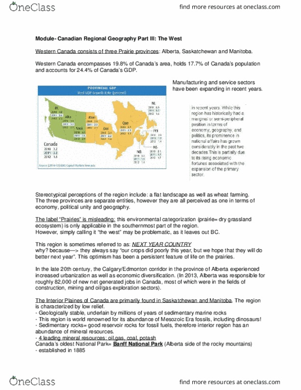
• Primary sector
• The manufacturing and service sectors have been expanding in recent year
• Growth is partially due to its rising economic fortunes associated with the expansion of the
primary sector.
Perceptions of the West
• Flat landscape
• Wheat farming
• The lael parries is misleading, however, as the environmental categorization (a prairie is a dry
grassland ecosystem) is only applicable to the southernmost part of the region
• the et ea out- crops did poorly one year but there are hopes that they will do better
next year
Urbanization
• Calgary/Edmonton corridor in the province of Alberta experienced increased urbanization as
well as economic diversification
• This highly urbanized region can be seen as a smaller scale version of the Windsor- Quebec city
urban axis in the industrial heartland of southern Ontario and southern Quebec
• 2013, Quebec was responsible for roughly 82,000 of new net jobs generated in the Canadian
economy
• Most jobs were in mining, construction, oil/gas exploration
Interior Plains
find more resources at oneclass.com
find more resources at oneclass.com

• Primarily found in Saskatchewan and Manitoba
• The region is characterized by low relief
• Geologically stable, underlain by million years of sedimentary marine rocks of remnants of
paleoenvironments that held a high level of biotic diversity.
• Striped appearance of the Alberta badlands- reveals the different depositional environments
occurring over hundreds of millions of years
• Mesozoic era- fossils
• Sedimentary rocks are often superb reservoir rocks for fossil fuels, and the interior region of
Canada is therefore of mineral resources.
• Oil, gas, coal, and potash are the four leading mineral resources in the region
Banff
• Alberta Side of the Rocky Mountains- Caadas oldest Natioal pak- 1885
• Canadian cordillera
• Construction of the Canadian Pacific Railway was integral to the development of the Canadian
Pacific Railway- integral to the development of the park bringing tourists from all over Canada
• 4 million tourists/ year
Physical Landscape
• Canadian shield and the Interior plains
• Influence of glaciation (not as prominent as Southern Ontario)
• Not detrimental to settlement as with the case with other regions (Ontario and Quebec)
• Prairie Grassland ecosystem was a deterrent to settlement until the advent of mechanized
agriculture
• This is because the deep intricate root systems of the prairie grasses made it extremely difficult
for farmers to work the land
• Bonanza: first settlers used this area, root systems of the grasses kept the sod solid that settlers
were able to build sod houses- beneficial since prairie land has no wood for building
Fertile Belt
• Region of Western Canada
• Continental climate- not large bodies of water, hot summers and cold winters, low precipitation
• Not favorable for agriculture
Palliser’s Triangle
• Continental climate
find more resources at oneclass.com
find more resources at oneclass.com

• Sub-regional variations in both temperature and precipitation
• East and west differences
East- conditions in southern Manitoba in the vicinity of Winnipeg, is desied as otietal
iteio
• With somewhat cold winters
• Black soil zone: tall grassland ecosystem where soils feature a high organize content and great
depth
West- Medicine hat Alberta Pallises tiagle is seiaid, ith feuet ate defiiencies
• The vegetation is sparse, mainly prairie grasses
• Soil is brown and shallow, high lime and salt content, and low organic matter making poor for
agriculture
Environmental Challenges
• Release of carbon dioxide and Sulphur dioxide from the Athabasca Tar Sands operations and
radioactive waste from abandoned uranium mines
• The volume of water diverted from the South and North Saskatchewan rivers have become an
issue
o Drought
o pollution
o Water usage
Captain John Pasiller Expedition- 1857
Identified two natural habitation zones:
• Semi-arid short grass zone (not suited for agriculture)
• Sub-humid area of tall grasses (suitable for agriculture)
Prerequisites for settlement at this time were:
1. A land survey
2. Separate lands for Native peoples
3. A rail link between the east and west
Settlement of the West
Influenced by large corporate entities
• Hudson Bay company- control of all lands drained by ricers into the Hudson Bay form 1670-1870
‘upets Lad
• Canadian Pacific Railway- granted title to some 25 million acres of land leading up to the
construction of the transcontinental railroad
Homesteaders
• The region was characterized by largely subsistence agriculture
• Large numbers of settlers were still required in the region in order to prevent norther US
expansion since earlier attempts at colonization were not successful
find more resources at oneclass.com
find more resources at oneclass.com