GEOG 2OC3 Lecture 8: The North

26 May 2018
School
Department
Course
Professor
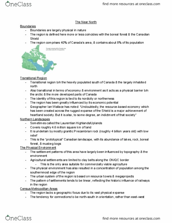
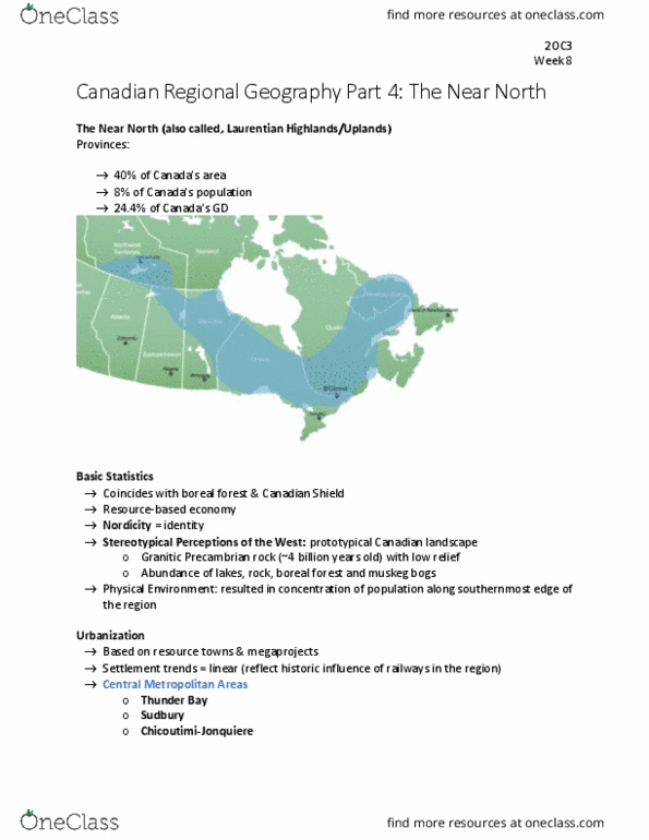
The Near North
• Boundaries are physical in nature
• 40% of Canada’s area and contains 8% of its population
Transitional regions
• Between the heavily populated south of Canada and the largely uninhabited north
• Physical barrier between the arctic and the more developed southern parts of Canada
• Resource based economy- ian wallace
Northern Landscapes- Laurentian Highlands/Uplands
• 4.6 million square kilometers
• Underlain by granitic Precambrian rock (4 billion years old) with low relief
• “Prototypical landscape’- lakes, rock, boreal forest, and muskeg
Physical Environment
• Settlement patterns influenced by topography and the environment
• Agricultural settlements are limited to clay belts along the Ontario/Quebec border, only
area suitable for commercially viable agriculture
• Concentration of population among the southernmost edge of the region
• The urban system of the region is based on resource towns and megaprojects
• Settlement patterns are linear, reflecting the historic influence of railways in the region
Central Metropolitan Areas
• Physical expanse, region lacks geographic focus
• North-south connections rather than east-west
Three largest areas
• Thunder bay: 2006- 122,907, 2011-21,596
• Sudbury: 2006- 158,258, 2011: 160,770
• Chicoutimi- jonquiere: 2006- 151, 643, 2011- 157,790
Strongly linked with Toronto and Montreal
Resources
• Forest products, minerals, and hydroelectric potential
Factors effecting resource development:
• Its far
• Concerns of human activity impact on the environment
• Native land claims and land rights also affect resource development in the region
Alternative ideas for industrial development:
• Retirement communities- elliot lake
• Abandon mines for waste disposal- timmins
• Eco-tourism- temagami