EESB04H3 Lecture Notes - Lecture 5: Voronoi Diagram, Rain Gauge, Water Cycle

11 Oct 2016
School
Department
Course
Professor

Document Summary
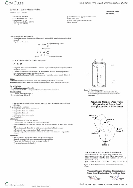
Lecture 5 precipitation measurement, snow & snowmelt. Several approaches have been devised for representing point measurements in region as area estimates of precipitation for an entire region (watershed) Most common methods: arithmetic average, thiessen polygons, hypsometric methods, isohyetal method. Rainfall not uniform therefore deals with averages. Only use gauges in watershed boundary (all other methods do use points outside watershed) Add up points/divide by number of gauges (average) To check, any point within polygon must be closest to point within then any other point. Need to know: entire area of watershed and area of each polygon. Lines of equal precipitation (same method as contouring) Find interval and follow rules of contouring. Numbered sections represent rain gauge catches for particular storm. Can use gauges outside watershed: obtain spatial patterning (visibly, bullseye = small convective rainfall, larger bullseye = frontal. Similar to isohyetal, but instead use elevation to get areas. In canada, snow is extremely important component of hydrological cycle.